
glosys Mining AI Overview
glosys Mining AI, One of the components of glosys AI Platform, provides AI & Cloud Software Suite and SaaS Applications and Services for AI and Analytics Team to focus on Mining Data Management, Annotation Automation, Model Management for Mining, MLOps Automation and Mining data security in the digital world
Features We offer
Mining Data Management
glosys Mining AI manages Mining data sets in terms of data extraction, transformation, loading and processing effectively
Mining Annotation Automation
glosys Mining AI focuses on auto-annotating, Mining image and video annotations, interpolate and fine tune the performance of the annotator for Mining data

Mining Models Management
glosys Mining AI leverages construction of Mining ML Pipelines, Auto-ML to develop production-ready Mining AI, Model Workflows, Models Hub and Model Metrics for Mining data
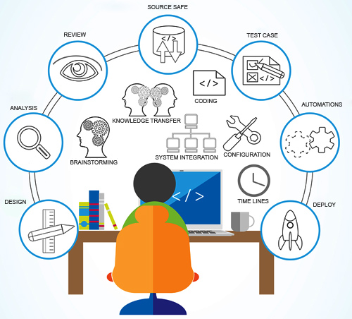
Mining MLOps Automation
glosys Mining AI harnesses the power of construction of Mining CI/CD AI Pipelines using built-in neural networks, python SDK, webhooks and advanced orchestration

Mining Data Security
glosys Mining AI protects and secures image and video data using security features such as roles management, profiles and permissions management, access control and field level security
Model Types glosys Mining AI leverages
Object Detection & Localization
Detect and locate the presence of multiple objects within an image, drawing bounding boxes around them to indicate their position and size
Learn More
Object Classification
Identify and assign a label or multiple labels to images based on the presence or absence of specific features or patterns within the image
Learn More
Captioning & Action Recognition
Automated process of generating textual description of an image, identify and classify human actions or movements within a video using action recognition
Learn More
Semantic Segmentation
Divide an image into distinct regions or segments, and assign labels representing the category of objects or features they belong to, to each individual pixel
Learn More
Instance Segmentation
Detect and delineate individual object instances within an image, and assign a unique label to each pixel that belongs to that instance
Learn More
Object Tracking
Follow or track the movement of one or more objects within a video sequence by detecting and matching features across frames.
Learn More
Usecases for Mining
Prospectivity Mapping of Critical Minerals
Analysis of Geophysical data such as Electrical, ElectroMagnetic (Magnetotellurics/VLF), Gravity and Magnetic, Depth data (Borehole)
Analysis of Geochemical data such as chemicals through rock powders, Lithium, Cobalt, Venadium
Plate Tectonics Models for Mineral Exploration
Focus on Deep sea sediment thickness, Oceanic Crustal or lithospherical properties, Downgoing Plates, Overriding Plates
Subduction Convergence Kinematic Statistics Generation using Gplates python library
Predicting the emplacement of Cordilleran Porphyry Copper (Cu) Systems
To generate copper mineralization prediction maps
Lithological Mapping Via Remote Sensing
Analysis of Lithology Types such as Quartz Monsonite, Dacite, Colluvium(hill), Scree and Talus (Slumps, Creek, Landslides, rockfall), Kurinigi, Mullai, Marutahm, Neiyathem, Pallai, Andesite (Igneous rock), Sandstone and shale (sedimentary rock), Younger Composite Fans and Terraces, Riverbed and Recent Alluvium, Older Composite Fans and Terraces, Light Red to Gray Sandstone
Geostatistics on Mineral Exploration
Extract chemical and physical parameters of complex surfaces
Focus on Summary Statistics on Geochemical data like Ore Geology
Map sand dunes for massive ore deposits
Remote Sensing for Mineral Exploration
Analysis of Features such as Lithological Units, Alteration Zones, Tectonic Structures (Fault, fold, shear zones) and Indicator Minerals (Path finding elements)
Analysis of Evidential Maps such as Lithological Map, Alteration Map, Structural Map, Minerals Map
Samples Analysis & Report Generation
Obtain accurate mineralogical information about inaccessible targets
Analysis of Samples using Optical Petrological microscope, Laser Raman Spectrometer, EPMA Instrument and reports are generated
Meet Your AI for Mining Objectives & Needs